Route

Route
Jonathan and Kirti Walpole's 950 km canoe journey across Northwest Territories and Nunavut in July and August of 2014

Day 22

Weather: Some tail wind, then calm, warm and very buggy, then increasing west wind to 20 mph
Distance: 66 km
Location: Latitude:64.80021, Longitude:-97.61208 at 08/03/2014 15:52:29 PDT
Map link: Click here

We were up at 3.30 am and on the water by 4.30 am. The conditions were good. It was fairly calm with a slight tailwind. Just enough to keep the bugs around our faces all day. We saw a skinny arctic fox on the lake shore. We also met up with Adam, Hillary, Jonah, and Elena again.

We briefly enjoyed some current assist through the narrows. We made good progress and even managed to complete the first 15 km section of Schultz Lake. The wind gradually increase until it was blowing 20 mph or so. Fortunately, it was behind us. We could have continued but we were exhausted by the time we had done 66 km of predominantly lake paddling. This hard effort has positioned us well though. We only have about 50 km of exposed paddling on Schultz Lake before we get back on the Thelon River and hopefully enjoy some current assistance.

We saw lots of fish today, especially in the short sections with current. As usual, the black flies are insane. They are currently hammering into our tent and it sounds like a heavy rain storm, even though its dry out.

Day 21

Weather: Windy, cloudy.
Distance: 0 km
Location: Latitude:64.60686, Longitude:-98.49954 at 08/02/2014 16:09:57 PDT
Map link: Click here

We woke up at 5.30 am ready to paddle, but the seas were quite rough, and the surf was roaring on the beach. A 20-25 mph wind was blowing from the west. We waited all day for the seas and surf to diminish, but they didn't, so this ended up being another rest day from paddling. The sky was grey and the barometer was steadily falling.

We hung around in the tent and finished reading Jon Turk's "Raven's Gift". We also sent our weekly message out on the inReach device. We have about 200 km to go, 100 km of which is exposed, so with almost three weeks of food left we can afford to be picky about the conditions we paddle in.

We went for a couple of short hikes, but did not see any animals today.

Day 20

Weather: Sunny, windy. Distance: 0 km
Location: Latitude:64.60683, Longitude:-98.49954 at 08/01/2014 14:42:29 PDT
Map link: Click here

We had a very windy night. The tent was flapping and buffeting so loudly that it was difficult to sleep. It is still windy today, and finally we have a break from the black flies. The wind is about 25 mph and coming from the west. There are lots of whitecaps on the lake, so we decided that this would be a good day for hiking. We are particularly well positioned for a hike up Peqetuaz Hill, which is very rugged and rocky with multiple layers of escarpments. It is one of the higher hills we have seen, at 237 meters.

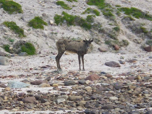
The hike was excellent. We were able to keep our bug hoods down all day, which was a new experience for this trip. The views were excellent, and we even saw a lone muskox grazing not far from our camp. We also saw a caribou on the beach. The huckleberries and cloud berries were abundant and we gorged ourselves.

This sunny but windy weather was lovely. It actually felt like we were on vacation. By 4pm the wind dropped slightly and the black flies came out again. They were hitting our hoods hard and it sounded like it was raining.

Day 19

Weather: South swell, southwest wind, cloudy, then gale force northerly wind in the afternoon with thunderstorms and heavy rain
Distance: 30 km
Location: Latitude:64.60681, Longitude:-98.49957 at 07/31/2014 17:43:03 PDT
Map link: Click here

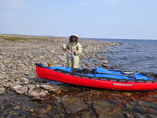
We started late this morning, around 10.45 am, because we were waiting for the surf to subside. We had 2+ feet of swell and wind waves out of the south. Launching through dumping surf is a bit tricky in a canoe. Its definitely not the optimal craft for these conditions. With wind and waves from the side, paddling on course required a lot of correction from the stern. The PakCanoe has a strong tendency to weathercock, which is generally a good characteristic for a rough water boat, but it requires continuous management by the stern paddler. Fortunately, the canoe is very stable and reassuring in bigger seas. We stopped a couple of times for a rest, but each stop required a surf landing and subsequent launch. These are complicated by the fact that the loaded PakCanoe can not be slid up or down the shore like a hardshell, so doing a tandem launch in dumping surf was hard.

By about 4pm the wind seemed to be calming down, but within 15 minutes an intense north wind started to blast across the lake. It was gusting 35 to 40 mph within minutes. Fortunately (and not be chance) we were close to shore and were able to land. If we had not been close to shore we would certainly have been blown off shore. As it was, even the last 50 m to shore was a hard battle. This was scary.

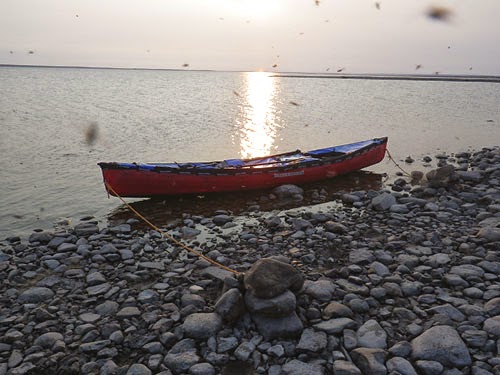
Once we landed we quickly searched for a sheltered spot to camp. As usual for the tundra, there weren't any real sheltered spots, but we found somewhere acceptable. We left some bags in the canoe and piles rocks into it too to prevent it from blowing away. This was in addition to tying off the bow and stern. Next we searched for two dozen large rocks to pile on top of our tent stakes. We also built a barrier of bags and rocks on the upwind side of our tent. Even though it was only a foot or so high, it helped deflect the blasts.

Once we had secured everything we retreated into the tent and snuggled down just as the thunder and lightning started and the rain began to thrash the tent.

Our 30 km today were hard earned. We have only 5 km left before the end of the exposed section of Aberdeen Lake, but it was not possible to make it given the conditions. It is interesting to note that just like the day before the last storm, the bugs were particularly insane yesterday. After its precipitous drop, the barometer has started to rise slightly.

Day 18

Weather: Smokey, hot, moderate wind and swell from the South, getting stronger by mid day
Distance: 49 km
Location: Latitude:64.53829, Longitude:-99.00211 at 07/30/2014 19:55:27 PDT
Map link: Click here

We got up early and were on the water by 3.45 am today. This was motivated by the prospect of paddling a very large expanse of exposed coastline. The wind and waves were coming from the south (on shore) and there was a 2+ foot swell rolling in. It was foggy or smokey or both and it felt much more like sea kayaking than river or lake canoeing. As experiences sea kayakers we felt at home in this environment, but couldn't help feeling that we were in the wrong craft for this. A canoe is too slow, too vulnerable to breaking waves, and has too much windage for exposed open water paddling.

The north shore of Aberdeen Lake is very shallow, with gravel and boulder bars extending out from shore 1 km or more much of the time. This meant that the south swell was steep and breaking quite far out from shore, so we had to paddle well away from shore in places. This made us quite exposed to sudden changes in wind direction (i.e. a wind from the north). The lake is huge and it was not possible to see the southern shore, even from high on the north shore.

Kirti found the conditions very challenging, with large waves from the side and intermittent surf and shoaling areas. The shallow areas also created a lot of hull-drag and made our progress slow. The wind picked up and it was hard to make any progress. At 10.30 am we decided to stop. We set up the tent to protect us from the bugs, which were surprisingly aggressive given the wind. We stopped here for several hours and had a meal and a snooze. We found a bird tag on the beach and saw another caribou.

The wind dropped slightly by mid afternoon and we decided to break camp and push on, given that we had about 60 km of exposed coastline to negotiate. We paddled for another 3 hours and covered 14 more km. It was difficult to find a good camping area as the shore was very low lying and the water level seemed to have recently dropped, so there were extensive wet, mossy, muddy areas.

Eventually, we found a camp. The black flies were horrendous - the worst yet. Without the bug shelter we would be eaten alive. Kirti reiterated her conviction to never come to the Thelon again.

Day 17

Weather: Hot, calm, muggy and buggy with smoke that limited visibility.
Distance: 45 km
Location: Latitude:64.61521, Longitude:-99.74786 at 07/29/2014 15:27:11 PDT
Map link: Click here

The weather was calm, hot, muggy, buggy and smokey yet again. We started paddling at 6.50 am and navigated through a maze of islands that is marked as the Thelon River, but is really an island filled lake. Most of our journey was not very exposed.

We ended the day at the start of Aberdeen Lake, which is a huge lake. It feels more like the sea than a lake. We saw two caribou, two arctic hares, some loons, sea gulls, eagles and arctic terns. The hares are enormous, like gigantic bunny rabbits.

We are camped on the tundra at the start of a peninsula. We walked out to the end of the peninsula in the evening, a round-trip distance of 6 km, and saw several tent rings and signs of older native settlements. In many of these areas there were a lot of broken caribou bones. We also saw several dumps of steel fuel drums, dozens of them, and one abandoned canoe out in the middle of the tundra.