Route

Route
Jonathan and Kirti Walpole's 950 km canoe journey across Northwest Territories and Nunavut in July and August of 2014

Day 3

Weather: Calm, smokey, hot, buggy
Distance: 37 km
Location: Latitude:63.70515, Longitude:-106.38274 at 07/15/2014 18:14:34 PDT
Map link: Click here

The visibility was very poor today, under 400 meters all day. It was like paddling in fog on the sea, but here the poor visibility was due to smoke that blew in from the south yesterday. Navigation was challenging. It was also hot and muggy all day, and conditions were totally calm, so we were surrounded by a dense cloud of blackflies all day. Occasionally unzipping the face shield of my bug suit to be able to see to navigate, resulted in a lot of bug bites on my throat and under my chin. These soon swelled up and were really itchy and annoying. The smoke was so thick that you could look directly at the mid day sun with the naked eye. It was just a dull red ball in the sky. Much of the day the visibility was too low to be able to see any scenary or wildlife. We did however spot a stoat on shore and several loons on the water.

We stopped for lunch on an esker here and had to set up the bug shelter in order to be able to eat. Drinking could be done through the mesh of the bug suit, but eating was more challenging. We felt as if we were under seige.

After lunch we paddled 10km and then stopped at an esker to hike.

Later we camped on another esker. Again we set up all three tents - sleeping tent, kitchen tent, and bathroom tent. We had a good bug-free wash in the bathroom tent, and long bug-killing sessions in the kitchen and sleeping tents.

Dinner was butternut and leak soup with barley. Very nice! By 10.30 pm the temperature in the tent had dropped to 70 degrees.

Day 2

Weather: Clear, sunny, windy, then smokey, calm, buggy, and eventually cloudy with some rain.
Distance: 46 km
Location: Latitude:63.57298, Longitude:-106.82217 at 07/14/2014 20:22:39 PDT
Map link: Click here

We launched at 7 am and quickly found the start of the Hanbury River in a quiet corner of the lake. At first there was just a slight hint of current in shallow water, then the waterway narrowed, rounded a corner and we found ourselves on a small, shallow river with frequent shallow rocky rapids. The action and the intimacy of the river was a wonderful change from the lake paddling we had yesterday. However, it soon became apparent that this really was a very low water year and that some of the rapids may not be runnable. At one stage we had to line and wrestle the canoe down a shallow set of rapids for 1 km or so. Several such sections ensued, and in between we had to be very vigilant about rocks and shallows, constantly keeping our speed in check by back setting. The Pakcanoe handled very well in these conditions, but whenever it ran aground, either with us in it or without, it did not slide over rocks and was quite difficult to drag through the shallow rocky rapids. In particular, it is not easily pulled sideways over shallow rocks like a hardshell is.

We soon entered Heuss Lake, followed by Smart Lake. The wind got up and was blowing quite hard from the side for a few km. Eventually, we had quartering seas and enjoyed the lively waves, trying to milk as much energy as we could. The wind got up to 20 mph and was fairly constant, setting up some nice rolling wave trains with small whitecaps.

We stopped for lunch at an esker where we saw a lone muskox. I carefully approached it, for photos, probably closer than I should have. It jumped up and ran back a bit before facing me. I quickly retreated. So did it. Later we saw it on the other side of the esker. It was quite animated, charging back and forth and rolling around in a big sand pit. It was much more energetic than we expected.

At this stage the weather was clear and sunny, with temperatures around 80. We had a nice lunch on the esker, and it was windy enough to keep the bugs at bay.We launched after lunch and enjoyed a few km of following seas, with fairly large waves. We were on the brink of being surfed a few times, but the Pakcanoe it not quite fast enough (especially when heavily loaded) to break free and surf easily. The energy spent trying to accelerate it up to surfing speed was probably not well spent, but we kept trying nevertheless.

By mid afternoon the south wind blew in a huge bank of smoke from the extensive forest fires to the south of us. Visibility dropped drastically, to 400 meters or less. It became quite difficult to navigate, and air quality was poor. The sun was a barely visible red ball in the middle of an otherwise cloudless sky. The wind dropped and the bugs came out in force. We eventually stopped at 7pm.

Later in the evening there was some thunder and a brief rain shower. The bugs were ferocious in the later part of the day, both on and off the water, and we had to seal up the hoods and face shields of our bugsuits and put our leather gloves on for the last couple of hours of our paddle, even though we were out on a lake.

Day 1

Weather: sunny, high 70s
Distance: 25 km
Location: Latitude:63.27299, Longitude:-106.88620 at 07/13/2014 10:22:40 PDT
Map link: click here

We met Dave Oleson at the float plane dock in Yellowknife at 8am. Chuck Tolley dropped us off, which made the logistics much more manageable. We loaded and fueled the plane, then took off around 9am. High winds, from the south, gusting 25 to 30 knots out on the lake, made the take off a little challenging, but we had some sheltered water in the bay. Dave said if the wind and waves got up much more then small planes like his would not be able to take off. Luckily we got away early enough and it was going to be calmer where we were heading. Dave was really well organized, safety concious and professional (just as we had heard). We were really happy to be flying with him. The flight was excellent. It was really smooth and neither of us had any hint of travel sickness, which we had been worried about beforehand.

Our flight path took us over the north shore and east arm of the Great Slave Lake. It looked beautiful, and would make an excellent canoe or sea kayak trip in its own right. We also saw a lot of forest fires, including the one that took Dave's home and guest cabin just a few days before. The smoke was blowing north, towards the tundra. We were worried that our trip might be affected by this.

We arrived at Campbell Lake around 11am. Dave found a suitable place to land beside a beautiful esker, and taxied the plane to a rocky shore where he could run the floats right up to the shore, enabling us to disembark without even getting our feet wet! Perfect service!

We unloaded the luggage and then watched as he taxied away , took off and disappeared into a clear blue sky. Once he had gone there was total silence. The lake was mirror calm and the lovely aroma of the tundra's aromatic plants filled our nostrils.

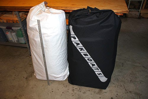
We spent an hour or so organizing our stuff, building the canoe, loading the bags, and fitting the spray deck. Once we were ready to leave it was time to make sure we knew precisely where we were. We didn't want to start out lost! As expected, we were close to the western end of Campbell Lake, right where we asked Dave to drop us, right here.

We paddled just over 25 km in about 4 hours, all on Campbell Lake. The weather was warm and sunny, and a light wind picked up to about 10 mph, creating side and quartering seas, just big enough to allow us a bit of assistance if the stern paddler kept the canoe aligned well enough for some diagonal runs. We are now camped about 1 km from the start of the Hanbury River and are eager to find out if it has enough water in it! Afterall, this is an exceptionally dry year. We are on a small headland with nice views all around. Our position does not offer much, if any, shelter, but the weather looks excellent and we hope to leave early in the morning.

The bugs have not been bad today. There have been a few, but they are easy to deal with. By 9pm the mosquitos are out, but we were already cozy in our tent and are now watching a nice sunset. The ground under the tent is dry but spongey, creating a plush 6" thick matress under our thermarests. The smell of the tundra plants is wonderful!

Today's wildlife consisted of many flightless geese and arctic terns.

We're Off!

This is the last post before we leave. We are flying out of Yellowknife at 8am tomorrow morning. After that you should, hopefully, see a SPOT message from us posted here most days. We may also occasionally send a message using the inReach device, which will appear on the location map in the right hand column of the blog (you'll have to click on the map and then click on the arrow representing the message).

We had a lovely day today with Chuck and Muriel. We went to the Yellowknife air show this morning, then had a nice guided tour around Yellowknife, a lovely dinner, and an evening viewing some pictures of Baker Lake and the Inuit Chuck and Muriel knew there from their years of living and teaching there in the 1960s and 1970s. They have some fascinating pictures that give a very intimate insight into the history of the place and its people.

Made it to Yellowknife!

We are finally in Yellowknife. It was a loooong drive! The only road into Yellowknife was closed today, due to forest fires, but fortunately for us, this happened just moments after we passed by the fire. The fire was almost at the road, with towering columns of dense smoke almost engulfing the road, as we drove by. Moments later we heard on the radio that the road was closed. That was close!

Aside from that we spent hour upon hour driving on straight roads with wide grassy shoulders and dense forests of small trees. It was hundreds of kilometers between gas stations. This aspect of the drive was pretty monotonous apart from a few points of significant interest - such as crossing the mighty Mackenzie river, which is enormous, our first views of the Great Slave Lake, which is enormous too, and this impressive and unexpected little waterfall on the Slave river. This really appeared out of nowhere!

The other memorable aspects of the past two days driving were the sheer scale of it all, and the ferocious swarms of horse flies that would engulf the car the moment we stopped anywhere, or even slowed down. This only started happening once we were in the Northwest Territories. Filling up at Fort Providence was a bit of a trial. Soon, however, we realized that they were really more interested in the car, and the dead insects all over it, than in us. Away from the car they didn't bother us at all, but summoning up the courage to get out of the car was the challenge (and back into it). Before we realized this we were marvelling at the toughness of Canadian flaggers who would stand out in the road dressed only in shorts and a T shirt and apparently not bat an eye to the bugs, while we cowered in our car surrounded by hoards of ferocious horse flies hammering on the windows. Also, while we were driving, the sound of bugs on the windscreen sounded like driving in a rainstorm.

Oh, and we saw a huge bison right by the roadside.

We are staying in Yellowknife with Chuck and Muriel Tolley, who are wonderful people. We have only done a brief tour so far, but Yellowknife seems to be a very nice town. Oh, and our float plane pilot, Dave Oleson, has very generously agreed to honor our arrangements and fly us out to the Hanbury river, despite having lost his home and guest cabin to a forest fire just a couple of days ago. What a guy!

Spectacular Drive!

After 2 days of driving, we are about half way through our drive to Yellowknife. Tonight, we are staying in Grand Cache, Alberta. The drive so far has been extremely scenic. Magnificent, in fact. Today we drove through the Canadian Rockies, right past Mt Robson and through Jasper National Park. The mountains are stupendous. We also saw some gigantic elk, right by the roadside.
Only another 1000 miles or so to go!

Fire!!!

Wild fire is the last kind of problem we expected on a tundra canoe trip, but the Northwest Territories are having one of the worst forest fire seasons on record. Roads into Yellowknife have been closed, intermittently, over the past few days, making our ability to get there to meet our float plane pilot uncertain. Much worse, though, we just heard that our pilot, Dave Oleson, lost his entire home and guest cabin to a taiga fire that burned through his property in the Hoarfrost river area on Friday and Saturday. This tragic loss of their home and business property must be devastating for the Oleson family. Fortunately, as far as we know, nobody was hurt.

The last entry in Dave's blog, from July 1st, comments on the fire approaching his property. It is particularly poignant reading the following comment in his last blog entry "If over the coming weeks the fire reaches the outskirts of our little homestead we are confident that with the right help from the local fire crews we could protect our buildings, our fuel cache out on the rocky point, and our livestock of the canine and feline varieties." The newspaper article I found after the burn said that high winds prevented the fire crews from being able to reach the property, and the owners tried valiantly, but ultimately unsuccessfully, to prevent the fire from consuming their home. How tragic.

Dave Oleson's Blog

Quite understandably, we have not heard anything from Dave since then regarding the flight for our canoe trip. Given that the time to leave Portland is now upon us, we have decided to try to drive up to Yellowknife anyway, and to make contact with Dave, if we can, over the next few days. If we can still fly with Dave, we will. If not we will look into getting a charter flight, at short notice, with one of the other Yellowknife operators. Failing that, we will spend a couple of smokey days in Yellowknife with Chuck and Muriel Tolley, then make our way back home and attempt this trip another year.

Can you find the route?

Ok, here is a challenge for you! Our planned drop-off point is the east end of Campbell Lake, which is the headwaters of the Hanbury river. Its coordinates are:

63.157611,-107.228966

If you start up Google Maps, select the satellite view, and paste in these coordinates, you should be able to zoom in and see where we start. See if you can find the Hanbury River and follow it to its junction with the Thelon. Its like solving a maze puzzle. Along the way, you should see some interesting features, such as white sand dunes and eskers. You will also see a lot of lakes. Its going to be an interesting trip and an interesting navigational challenge.

The end of our trip, at Baker Lake, is at the following coordinates:

64.319086,-96.021881

Traditional lifestyle of the Inuit

Ahead of our journey, we've been trying to learn more about the Inuit people, and especially their traditional ways of living off the land. There is an absolutely fascinating series of films, available on the National Film Board of Canada website, that give great insight into this. The films were shot in the 1960s using the last generation of Inuit who actually lived that way. There is no commentary, nor interpretation to misrepresent their lifestyle, just footage of actual activities. These films are really well done, and I think this is a brilliant and insightful educational approach. If you want to see what its like living out on the tundra in summer, check out the films "Fishing at the Stone Weir" or "At the Caribou Crossing Place". All the ones I've watched so far are great. These are incredibly tough and creative people. Here is the link:

Traditional Inuit Lifestyle Films by Quentin Brown

Some interesting facts ...

Location: Although seemingly very far north and east, the end point of our route at Qamani'tuaq (Baker Lake) is actually less than 25 miles from the geographical center of Canada. Needless to say, Canada is a really big country!

Population Density: Nunavut, which is the province we cross into for the second half of our journey, is the most northerly of the Canadian provinces. It is also the largest Canadian province. With a surface area larger than Alaska, and a population that is less than one twentieth that of Alaska's, it is one of the most sparsly populated regions on earth.

People: Paleo-Eskimos, nomadic hunters, came to the region 8000 years ago. Archaic Indians also hunted in the region several thousand years ago. 1000 years ago, Thule Eskimos, the ancestors of the modern Inuit, came to the area. They lived primarily on the coast, but travelled inland to Baker Lake and up the Thelon River to hunt caribou. In the 17th and 18th centuries, some of the Thule, sometimes referred to as the Caribou Inuit, began to stay permanently inland. In the 1920s and 1930s trading posts, missions, and the RCMP, were established in Baker Lake. This had a dramatic impact on the Inuit, and by the 1960s (within my own lifetime!) most of the Inuit inhabitants of the region had settled in town. This change from the traditional to modern ways of living happened recently enough that there are still a few people who remember living off the land in the old way. Hopefully, we will have a chance to meet some of these people in Qamani'tuaq at the end of our journey!

Communications

We spent part of the day testing our various communication devices. We have opted to go with a SPOT and a DeLorme inReach device. The SPOT will allow us to send daily updates of our location. These will be sent to a shortlist of people on our email list. They will also be automatically published on this blog for everyone else to see. The SPOT device has a messaging facility and an SOS capability. Two of our friends (Dan Haghighi and Joel Grover) have agreed to be our emergency contacts and will help coordinate activities should we need help. The SPOT device communicates using the Globalstar satellite network.

Our DeLorme inReach device supports two-way text messaging via the Iridium satellite network. It allows us to send and receive text messages up to 160 characters in length. We intend to use this device primarily for communication in the event of problems. Our friends Dan and Joel will have the necessary contact information for coordinating an evacuation in the, hopefully unlikely, event that we need one. To conserve battery life we do not intend to use this device for regular updates.

If you don't hear from us, don't worry! We have 6 weeks of food with us and we intend to travel only when it is appropriate give the conditions.

Test Paddle

We took the PakCanoe out on the Clackamas river for a quick test paddle. Conclusion: it paddles pretty much like a general purpose Royalex canoe. You can feel that it is a bit slower than a hard shell canoe, and you have to approach shallows more cautiously because it doesn't slide over rocks like a Royalex canoe. You can also feel some torsional flex in the hull, which means that it doesn't carve into and out of eddies quite as cleanly as a hard shell. However, there wasn't nearly as much flex as we expected. Overall, it responds to all the standard strokes and maneuvers the way you would expect of a hardshell general purpose canoe. This is comforting to know, because it means that we can paddle it pretty much the same way we would paddle the Royalex Esquif Canyon canoe we are used to. The PakCanoe feels very stable and friendly on the water, which is reassuring, and a good characteristic for an expedition boat.
The foam floors we made worked really well. It feels great with them (and pretty much unusable without them), so the effort was definitely worthwhile. We were even able to pole and snub the canoe up and down a few swift sections. Standing on the foam floors was more stable than standing directly on the skin of the hull or the frame components, but somewhat to our surprise, poling was possible either way. The stability is a nice bonus for poling.
At the end of our test run we even got to see how it faired in some interesting weather conditions. I think its going to work well for our trip.
Thanks to Jenny Johnson for taking the pictures! She is off on an adventure of her own, also in a PakCanoe. She left today for a 5-week Crossing of Ungava.

Sweatshop Labor

We've had to put in long hours at the sewing machine for very low wages (none in fact!) in order to make various pieces of equipment needed for the journey. These include the portage harnesses discussed in the last post, making some modifications to our canoe spray deck, making canoe paddle attachment points for various shelters so we don't need to take as many poles, and making a lightweight bathroom bug shelter. All in all, our 1950's Singer 15-91 has more than earned its keep.
The spray deck modifications include making and fitting paddle park attachments for regular and short, bent-shaft, spare paddles, restraining loops for stowing the spray skirt tunnel extensions when not in use in warm weather, and tie down points for map cases and a deck compass.
The small bathroom bug shelter is part of our preparation for calm days when the black flies and mosquitoes are unbearable. We have bug jackets, pants and gloves, but we've read that the bugs can come out in unimaginable numbers, making it difficult to wash or go to the toilet without being eaten alive. The saying goes that "In the Barren Lands you eat fast and shit even faster!". Our small, lightweight, fast-setup bug shelter weighs just over a pound and can be set up in less than a minute. It has valences to completely seal to the ground and can be pitched with stakes, deadman anchors, rocks, or sand. With felded seams, triple stitched, we hope it will be enough to keep the bugs at bay when we need a quick break. We also have a larger kitchen tent that is bug, wind and rain proof and can offer plenty of ventilation when its hot. We expect to use that one most days for meals and relaxing. And we have our sleeping tent for, well, sleeping. So, lots of redundancy in our shelters.

Maps, maps, maps ...

A journey like this requires a lot of maps! We have a complete set of 1:50,000 scale topographic maps for the route. There are 39 of them in all. We also have a set of 1:250,000 scale topographic maps for an overview and to provide some redundancy in case we lose some of the other maps. There are 6 of these, and they will be stored separately from the detailed maps. So, 45 maps at $12 each, plus shipping, cost us well over $550. Then the hard work began, trimming whitespace boundaries and redundant key information, and transferring important navigational information from the trimmed areas to the maps themselves. That task alone took a few days! The magnetic declination and annual change data for these maps is just crazy. The problem is that we are very close to the magnetic north pole, so magnetic compasses behave erratically and the declination varies drastically from one side of the map to the other, and is changing by almost a degree per year in some places, based on a 35 year old survey! Better take a GPS along too!

On the water we will carry just the maps we need for the day in a waterproof chart case on the spray deck. The other maps will be stored all together (in two separate batches) in chart cases inside the canoe, inside our big dry bags. For added protection, each paper map is also treated, on both sides, with Mapseal waterproofing agent. Doing the waterproofing is another full day of work, and we ended up with a house full of drying maps.

Finally, with all the maps prepared and waterproofed its time to look at the whole route again in more detail. Unfortunately, our house is only big enough to lay out the maps for half the route at a time. Here is a picture of the maps for the second half of the trip. After carefully measuring the river miles, we've had to update the distance for the whole journey to 950 km. The mileage is split roughly 50%-50% between rivers and lakes, so this could take a while, especially if its windy (which I hear it is most of the time). I think we better pack an extra week of food!

Beasts of Burden

Portaging is the art of carrying a canoe and gear around a section of river you don't want to run. There are several portages on the Hanbury river section of our route where the river drops over waterfalls or goes through gorges with unrunnable rapids. Altogether, there are 7 or 8 of these, with the longest, around Dickson Canyon, being about 3 miles. Portaging is hard work, and there may be no way to do it with style or comfort. However, we have put some thought and effort into improving our chances. First, we have all our gear stowed in a small number of large waterproof dry bags, which are not too large or heavy to carry. Inside these bags everything is stored in smaller dry bags, so we have double protection from the elements. The bags can be strapped onto an external pack frame using harnesses we designed and sewed ourselves. Using an external pack frame allows the weight to be distributed comfortably on the hips, with little weight on the shoulders. These frames make a huge difference in comfort over longer distances and are well worth the minimal cost of space and weight.
We have three large gear bags which stow cleanly and easily in the canoe. They occupy all the space below the gunwales/spray deck and provide good support for the canoe frame as well as good floatation. The portage pack frames lie on top of the bags and the whole load is strapped down to the canoe frame's keel using a couple of loop straps. An additional smaller dry bag contains the things we need during the day and is easily accessible from the stern cockpit area. With all our gear stowed this way, the ends of the canoe can be left light and filled with floatation bags.
Each portage in the early part of our journey will require 3 passes with load - one with a big orange bag each, one with the blue bag, day bag and all the canoe gear, paddles, etc, and one with the canoe. With the walk back between each pass, that means traveling 5 times the portage distance, so a 3 mile portage becomes a 15 mile hike with load. This will not be easy, but we can do it. Later in the journey when we have consumed some of the food we should be able to portage in two passes with load, or three total. Unfortunately, nearly all the portaging is in the early part of our trip. We have been training for the portages by doing 2+ mile hilly hikes around our local nature park. We go most evenings and have gradually increased the load in our packs to the point where we are now doing it fairly comfortably with 50 lbs. The route has a 400 ft climb, so in terms of its elevation gain at least, its probably harder than what we will encounter on the Hanbury. The prospect of these portages is still a little daunting, but not nearly as daunting as it was before.

Yes, the canoe really packs into a bag!

The earlier pictures make the PakCanoe look just like a normal canoe. It doesn't look like it would fold up and pack in a bag. So, here are a few pictures of it being broken down. Without its spray deck the skin on frame construction is more easily seen.
Half an hour of undoing clips and disconnecting parts sees the canoe broken down into its basic components. Its actually not too difficult, but it would be difficult to do it much quicker than a half an hour (building or dismantling). You can see the new more robust seats we made on top of the pile.
Finally, it all goes into a bag. Well, two bags. Since the foam floors we made are a bit bulky, we pack them, together with the frame components in one bag (the black one) and the canoe skin and spray deck together in another bag (the white one). There is a 36" ruler resting on the white bag to give an idea of the size of the two packages. Each is fairly easy to portage, especially using the portage system we have devised, which will be discussed in the next post. Alternatively, the canoe can be portaged like a regular canoe using its removable portage yoke (not seen in any of the pictures).

Our PakCanoe 170

We just finished outfitting our new PakCanoe 170. Getting it expedition ready was quite a lot of work, and that has been taking up most of our time for the past few days. We had to design and make foam floor inserts for bow and stern, replace the bow and stern seats with a more robust design -- which we had to design, fit end float bags, and install our existing Northwater spray deck, which as luck would have it fits both our Esquif Canyon and our PakCanoe 170. We also had to make several modifications to the Northwater spray deck, so we put in quite a few hours on the sewing machine too.

We'll post a few details and pictures of the modifications we made, but first, here are a few pictures of the canoe all kitted out with its spray deck and our gear loaded inside.